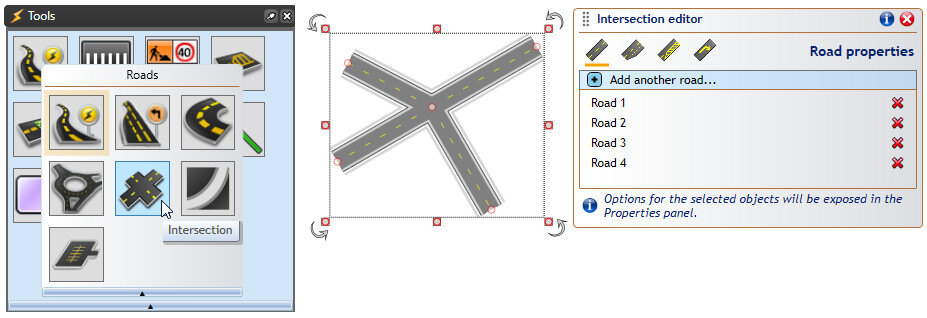
The Intersections Editor tool can be used to create complex intersections with just a few mouse clic...


The Intersections Editor tool can be used to create complex intersections with just a few mouse clic...

What’s new in this update? Intersections Editor: Create complex intersections with just a few mouse ...

What’s new in this update? Print Frames and In-Place Print Preview: Frames allow drawing titleboxes ...

In georeferenced images, actual image data – typically maps or aerial photos – is accompanied by geo...

National WorkZone Awareness Week (NWZAW) is an annual event that takes place across the United State...

What’s new in this update? Control Point Snapping and Road Alignment: Precisely connect objects with...
Stay updated with our latest product updates, industry news, and insights, delivered to your inbox.
Never miss an update!