Nearmap subscribers in the USA, Australia and New Zealand can now access Nearmap aerial images (incl...
Nearmap subscribers in the USA, Australia and New Zealand can now access Nearmap aerial images (incl...
RapidPlan now integrates with the Eagleview Australia (formerly Spookfish*) API. RapidPlan customers...

ATTSA’s 49th Annual Convention and Traffic Expo marked the 16th year Invarion has exhibited at the e...
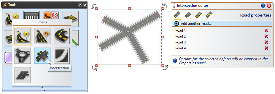
The Intersections Editor tool can be used to create complex intersections with just a few mouse clic...
In georeferenced images, actual image data – typically maps or aerial photos – is accompanied by geo...
Please note that SIX Maps is a spatial mapping service provided by the Government of New South Wales...